


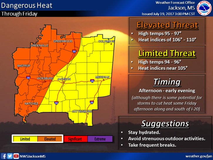
North Mississippi beginning to see some rain chances creep in as you close out the work week: scattered thunderstorms will mark your afternoon, so grab your umbrella before you hit the door. Chances are low, but best to be prepared. The REAL threat will be from another day of dangerous heat: temperatures will push into the mid- and upper- 90s again, with heat indices launching into the triple digits.
Across the central part of the state, you can expect highs in the mid 90s as well, feeling like over a hundred in many places. Tonight’s low reaching the mid 70s, but expect heavy, dangerous heat to return tomorrow. Also, you can look for a better chance to catch a stray thunderstorm tomorrow as well.
South Mississippi seeing increased heat today as well: highs pushing into the lower 90s with a chance for rain, though if you get any showers they’ll be spotty and short-lived today.