


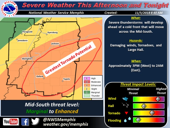
It’s only been a few days since at least a dozen tornados hit Mississippi, and the state is once again preparing for the potential threat of severe weather.
According to the National Weather Service, residents in both north and central Mississippi should brace for severe weather tonight and into the early morning hours of Tuesday.
The potential threat will begin in north Mississippi this afternoon and continue into the night, and the storm will weaken as it moves through the rest of the state.
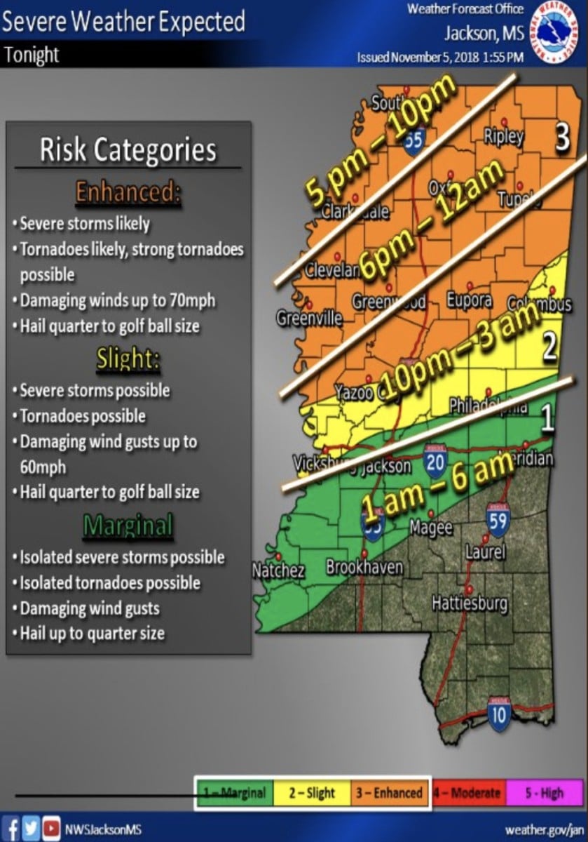
The NWS also posted this graphic, which shows the areas which will see the highest potential for tornados.
Central Mississippi will also see the threat of severe weather.
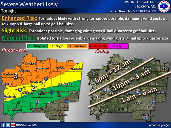
“Severe thunderstorms are expected tonight, mainly north of the I-20 corridor. The main risk will be for tornadoes, some of which could be strong, across the northern portion of the area. Damaging wind gusts up to 70mph & large hail up to golf ball size will also be possible. The threat will generally decrease through the late night hours as a line of storms moves southeast. The line of storms may diminish entirely before reaching the Pine Belt.” – NWS Jackson
Be sure to prepare for a potential loss of power ahead of time, and check for updates throughout the night.