


Update:
Weather can change in the blink of an eye, and luckily for Mississippi, it appears that we will miss most of the impact of tropical storm “Alberto”. The latest projections from the National Weather Service show the storm trending away from the Gulf Coast and diverting toward Alabama.
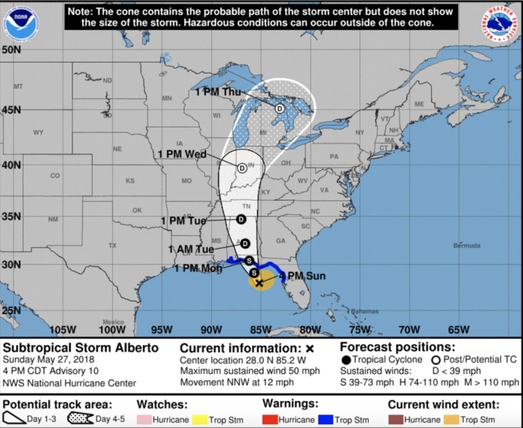
While current projections are favorable for Mississippi, the NWS warns that you should continue to watch the forecast just in case the storm shifts again.
“The latest trend is for Alberto to track inland farther east into Alabama, which increases confidence the high potential of flooding will be focused east of our region. However, there still remains potential for Alberto to bring locally heavy rains to the eastern areas Monday into Tuesday and some flooding issues cannot yet be ruled out. Please continue to monitor the latest forecast updates from the National Weather Service and the National Hurricane Center.”
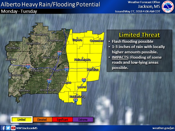
A limited threat of flash flooding remains for certain areas.
Original Report:
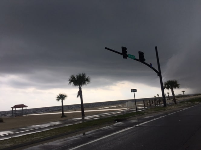
As Mississippi continues to prepare for tropical storm “Alberto”, Governor Bryant has declared a state of emergency.
“With subtropical storm Alberto headed toward the Coast, we are preparing to respond. [Friday], I signed a proclamation declaring a state of emergency and an order making the National Guard and other state resources available should they become necessary.”
Current projections from the National Weather Service show that the storm is expected to reach the Mississippi Gulf Coast on Monday and will likely extend through Tuesday/Wednesday of next week.
Greg Flynn with MEMA says the rainfall continues to be the main concern. Certain areas on the coast and up through south and central Mississippi may see flash floods as the storm moves through the state.
“There are some areas that could see 10-15 inches of rain, it’s certainly possible. If you’re just in the wrong place at the wrong time, those rain bands will set up over you, and you could see an isolated amount that high.”
Even though the storm is moving slow, Flynn noted that it is important to be prepared ahead of time. While the Coast may be a travel destination for many on this Memorial Day weekend, those plans may need to be altered.
“Make sure you have a plan to be ready to move as soon as the water comes up,” he said. “I know it is a holiday weekend but take that into account depending upon where you’re going. If you’re thinking about going down to the Gulf Coast for Memorial Day, that’s probably not the best idea right now, whether that be from the panhandle of Florida through Alabama or the Mississippi Gulf Coast…better to be safe than sorry.”
Thankfully, the storm will not reach hurricane wind speeds, but MEMA warns that winds still may reach 40-50 MPH. The storm will be a tropical storm when it hits, but it will downgrade to a tropical depression shortly after reaching land.
Because the threat of severe weather remains, Flynn recommends preparing your emergency supply kit which includes bottled water, non-perishable food, a flashlight, batteries and other items.
“Any item that you will need to sustain yourself for at least three days without electricity,” he noted. “We always play a worst-case scenario and say, ‘if you’re without power for 3-5 days, do you have what it takes to sustain on your own?’ This includes not being able to go to a gas station or a grocery store, so the more self-reliant you can be, and the more supplies you can stock up in your house, the better of you’ll be.”
For those on the Coast where the storm will be at its highest intensity, MEMA released a full list of sandbag pick-up locations.
MEMA continues to remind Mississippians to have a plan for flash-flooding and hurricanes to reduce the risk of injury or death.