


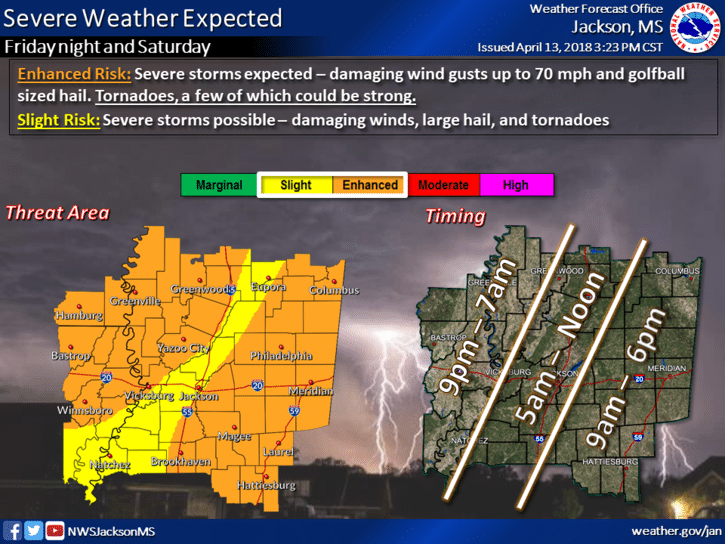
Mississippians could see severe weather tonight, according to the National Weather Service.
Meteorologist Greg Garrett says that a storm system will work its way across the state, moving from west to east. The storm could bring an enhanced risk of severe storms with winds up to 70 mph, golf ball sized hail and 3-5 inches of rainfall.
The initial risk of storms will begin the Delta area 9 p.m. and remain across portions of the state through Saturday. Garret says that tornado watches and warnings could be issued throughout the night.
Warnings save lives! Make sure you know the difference between a watch and a warning. pic.twitter.com/vm1HuQNBud
— NWS Jackson MS (@NWSJacksonMS) April 13, 2018
As the storm moves east, it could weaken in certain areas toward the middle of the state, but Garret says that storms could re-fire in the morning and extend through Saturday afternoon in the east. The rainfall will be consistent throughout the storm. This will be a slow-moving system which could cause flash floods.
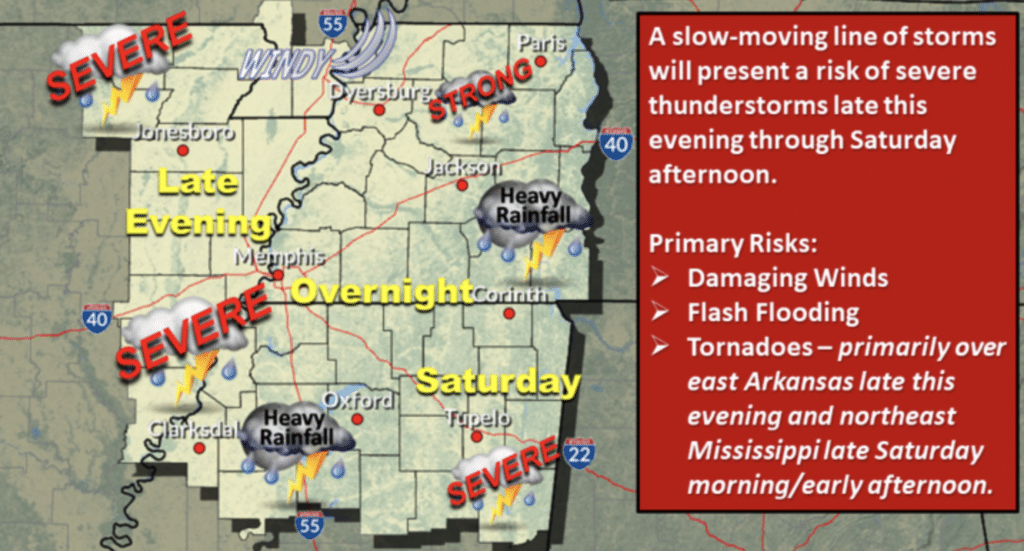
Garrett warned that Mississippians need to stay alert and continue to keep an eye on the weather as the night moves along.
Make sure to have a severe weather safety plan in place and know where to go! pic.twitter.com/9Omi3UiehU
— NWS Jackson MS (@NWSJacksonMS) April 13, 2018
Here are a few tips on what to have in your emergency kit. Be prepared! pic.twitter.com/2xTkHoiv25
— NWS Jackson MS (@NWSJacksonMS) April 13, 2018