


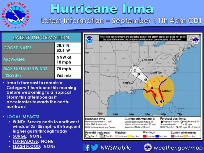
Irma has now weakened to a tropical storm as it crawls up the west coast of Florida, with sights set on north and east Mississippi.
Rain and gusty winds are really all the impact that Mississippi will see as Irma begins to dissipate: Mike Edmonston with the National Weather Service says a wind advisory will go into place this afternoon around 4 o’clock.
Beginning in Clark County in the south, to Tupelo in the north and stretching across to the Memphis area, you can expect winds gusting upward of 30 miles an hour.
Irma’s also affecting the thermometer. Expect daytime temperatures to drop even further this week. Record low maximum temperatures are forecast as highs struggle to reach the mid 60s Tuesday. Rain and heavy cloud cover will keep things cool in the northern half of the state, but you can expect a warming trend this weekend.