



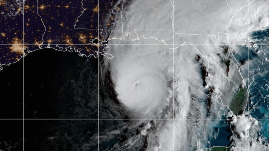
Isaias strengthened Friday morning into a Category 3 hurricane as it barrels toward the U.S. Gulf Coast, the National Hurricane Center said.
The major hurricane is forecast to make landfall late Friday somewhere along the Alabama-Florida line and create dangerous conditions in the Florida Panhandle, southern Alabama, and southern Mississippi. As of 7 a.m., nearly two dozen Mississippi counties had been placed under some form of watch or warning.

Hurricane warning
- Jackson County
Tropical storm warning
- Hancock
- Harrison
- George
- Greene
Tropical storm watch
- Clay
- Oktibbeha
- Lowndes
- Winston
- Noxubee
- Neshoba
- Kemper
- Newton
- Lauderdale
- Jasper
- Clark
- Jones
- Wayne
- Forrest
- Perry
- Stone
The NHC classifies a hurricane warning as expected hurricane conditions, so residents should evacuate and prepare as if the hurricane will affect them. The same goes for a tropical storm warning, where Isaias is expected to weaken to a tropical storm as it moves farther inland. However, a tropical storm watch is described as an area where tropical storm conditions are possible but not fully guaranteed.
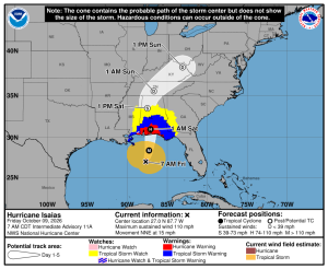
As of early Friday morning, Isaias was packing 120 mph winds and was expected to continue strengthening. Category 3 storms, considered major hurricanes, are capable of causing devastating damage, the NHC warned. Along with the projected heavy rainfall, the NHC is also expecting damaging hurricane-force winds for eastern Mississippi and life-threatening storm surge along the entirety of the Mississippi Gulf Coast.
Isaias is expected to weaken quickly as it hits shore and be downgraded to a tropical storm by Saturday afternoon as it moves north and inland along the Alabama-Mississippi line, the center said. Either way, NHC and Mississippi Emergency Management Agency officials are urging residents to prepare for rough conditions.
“Preparations should be rushed to completion as the weather will go downhill pretty quickly today (Friday),” the hurricane center said in an early-morning forecast. “While the storm is not expected to make landfall at peak intensity, it is likely that Isaias will still be a significant hurricane when it reaches the coast.”
“The threat is real, and now is the time to prepare,” MEMA Executive Director Stephen McCraney said to residents who have not yet done so, as the state agency has spent the entire week urging those in southern Mississippi and other areas to collect necessary supplies and have evacuation and emergency plans in place.
Isaias, the first hurricane of the Atlantic season, was centered about 200 miles south-southeast of the mouth of the Mississippi River and moving to the north at about 15 mph at the time of the NHC’s 7 a.m. update. It is expected to make landfall between Mobile Bay on the Alabama coast and Choctawhatchee Bay in the Florida Panhandle in the evening.
Besides wind and storm surges, the hurricane will likely bring flash flooding and spawn tornadoes, the NHC said.
The Associated Press contributed to this report.