As the number of COVID-19 cases rises across the U.S., an easy-to-use online tool has been developed to determine risk in a specific area.
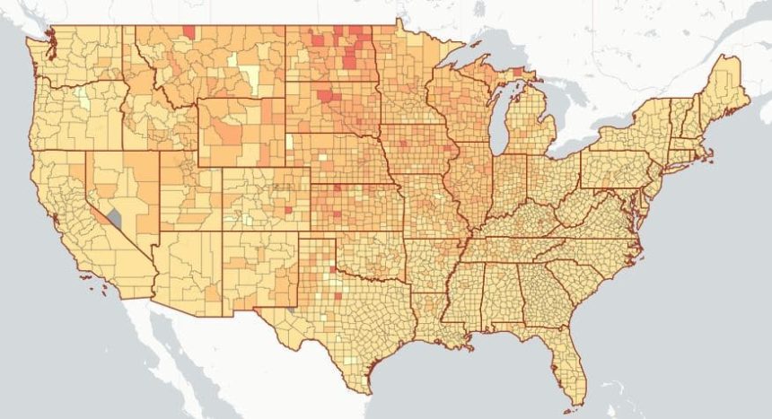
The map shows the risk level of attending an event, given the event size and location. The risk level is the estimated chance (0-100%) that at least 1 COVID-19 positive individual will be present at an event in a county, given the size of the event.
If you are traveling to another state for a holiday event, you can determine the risk assessment for that area as well.

The interactive map was created by professors with the Georgia Institute of Technology, along with researchers at the Applied Bioinformatics Laboratory and Stanford University.
Click here to see the map and to see the risk probability in any county in the U.S.
The developers remind you that the risk that one case becomes many can be reduced by wearing a mask, distancing, and gathering outdoors in smaller groups.