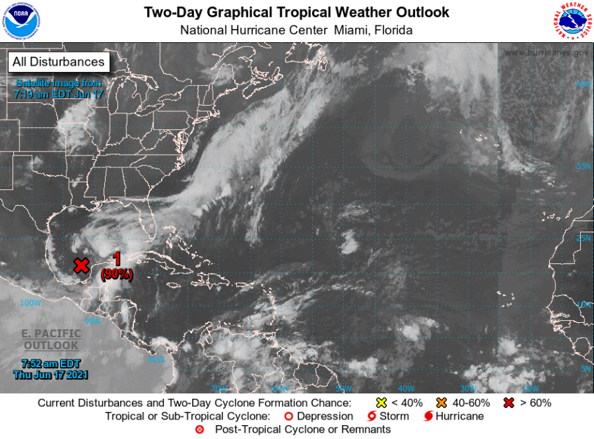
A tropical depression is expected to form over the west-central Gulf of Mexico tonight or early tomorrow. The main concern from this system is the possibility of up to ten inches of flooding rains that could begin early tomorrow. Tornadoes and gusty winds of 35-40mph are also possible. Landfall is expected sometime Saturday morning in Louisiana.

Tropical Weather Outlook
NWS National Hurricane Center Miami FL
800 AM EDT Thu Jun 17 2021

For the North Atlantic...Caribbean Sea and the Gulf of Mexico:

1. A broad area of low pressure over the southwestern Gulf of Mexico
is producing widespread but disorganized cloudiness, showers, and
thunderstorms.  This system is expected to move northward, and a
tropical or subtropical depression is likely to form over the
west-central Gulf of Mexico tonight or early Friday.  An Air Force
Reserve Unit reconnaissance aircraft is scheduled to investigate the
disturbance this afternoon, if necessary.  Regardless of
development, heavy rainfall will continue over portions of Central
America and southern Mexico during the next few days.  Heavy rains
should also begin to affect portions of the northern Gulf Coast on
Friday.  Please consult products from your local meteorological
service for more information.
* Formation chance through 48 hours...high...90 percent.
* Formation chance through 5 days...high...90 percent.

Forecaster Pasch


