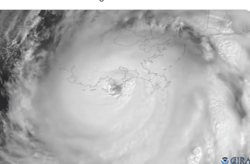
Radar Image Courtesy of NOAA
16 years to the day that Hurricane Katrina made landfall, Hurricane Ida officially reached the Louisiana Coast as a Category 4 storm.

Ida made landfall around Grand Isle, Louisiana with 150 mph winds and the Associated Press is reporting that it is tied for the fifth strongest hurricane to ever make landfall in the U.S. based on wind speed.
Video footage from Grand Isle as Hurricane Ida makes landfall pic.twitter.com/dLijXbGLc4
— wdsu (@wdsu) August 29, 2021
The storm remains on track to enter the state of Mississippi late Sunday night/early Monday morning.
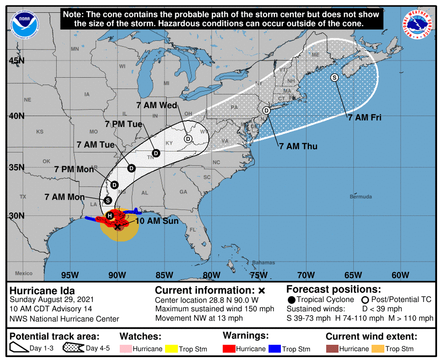
The latest update from the National Hurricane Center indicates that storm surges along the Mississippi Gulf Coast could be between 6-9 feet from Bay St. Louis to Ocean Springs and between 4-7 feet from there to the Alabama border.
In Hancock County, a mandatory order was previously ordered for all low lying areas, residents living on rivers, river inlets, bayou creeks and mobile homes. A voluntary evacuation order for all low lying areas was also issued in Harrison County.
Bay St. Louis, Diamondhead, and Waveland have issued a curfew beginning Sunday, August 29, 2021 at 6:00 P.M. and ending Monday, August 30, 2021 at 6:00 A.M.
A list of open shelters in Mississippi can be found – here
Rainfall totals will also be a concern. Total rainfall accumulations of 10 to 18 inches with isolated maximum amounts of 24 inches are possible across Southeast Louisiana into far South Mississippi through Monday. This is likely to result in life-threatening flash and urban flooding and significant riverine flooding impacts.
Central Mississippi could experience 4-8 inches of rain with isolated maximum amounts of 12 inches, tonight through Monday night.
Stunning video taken from inside the eye of #Ida this morning by the NESDIS Ocean Winds Research team during a flight on the @NOAA_HurrHunter P3 aircraft @NOAASatellites pic.twitter.com/sjt970Yeiq
— National Hurricane Center (@NHC_Atlantic) August 29, 2021
The Gulf Coast will bear the brunt of the storm, but residents across the state should brace for high winds and heavy rainfall. Spin up tornadoes also remain a possibility.
Wind Timing/Impacts: Gusty winds will be a major impact as Ida moves inland. Here is a chart showing the time frame when we are expecting the strongest wind gusts in selected cities across the area. pic.twitter.com/VeSV2ACwJK
— NWS Jackson MS (@NWSJacksonMS) August 29, 2021
Continue to stay weather aware and follow any evacuation orders given by local officials.