The first storm of hurricane season is on its way to the coast.
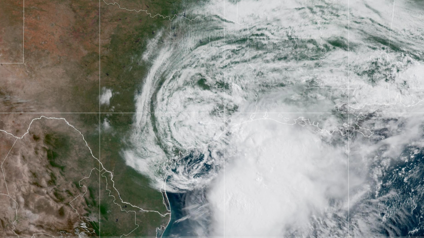
Tropical Storm Arthur formed in the Atlantic Ocean on Wednesday morning and made its initial landfall near the Texas-Louisiana border with 45 mph winds. According to The Weather Channel, this year’s “A” storm is on schedule, appearing around three days earlier than the average first storm of each Atlantic hurricane season.

Thankfully, Mississippi did not receive Arthur’s immediate landfall, but that doesn’t mean the Magnolia State will get by completely unscathed. The main threats from Arthur will be heavy rainfall and flash floods.
Heavy rain is expected in various parts of Mississippi, starting on Thursday and continuing through the night into Friday. The National Oceanic and Atmospheric Administration expects five to ten inches of rain in Texas, Louisiana, Mississippi, Alabama, and parts of Georgia and Florida.
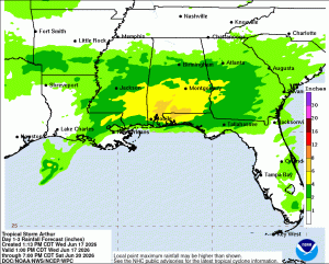
While Mississippi wasn’t under a tropical storm warning as of Wednesday afternoon, it is under a flood watch in parts of central and southern Mississippi. Citizens in Harrison, Hancock, Jackson, and Pearl River counties can find information on how to get sandbags to prepare for potential flooding here.
Arthur isn’t the only thing to be aware of this weekend – tornadoes are also a real possibility. One was spotted near the eastern border of Alabama earlier this week, driven by tropical moisture and high winds along the coast, creating perfect conditions for short-lived tornadoes.
Keep up with the latest forecast in Mississippi here.