According to the National Weather Service, heavy rainfall and flash flooding will be a threat from Hurricane Sally beginning today and continuing into early Thursday.
The highest rainfall amounts will be near areas close to the center of circulation and east.
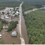
Locations across the Pine Belt and the I-59 corridor could see 6 to 12 inches.

Other areas in southeast and east-central Mississippi could see amounts of 4 to 8 inches.
The western side of Sally will have a sharp precipitation gradient where some locations may see little rain.

Strong winds associated with Sally, look to bring some impacts to portions of our forecast area as early as this afternoon.
The strongest winds will be across the Pine Belt region and I-59.
Other peripheral gusty conditions will exist across southern, central, and east-central Mississippi as well.
Downed trees and power outages can be expected in the greatest threat area as Sally moves inland. Secure loose items, and if possible remove dead tree limbs near homes before strong winds develop.