Friday will be mostly cloudy with scattered showers as much of the state braces for an ice storm forecast to his as soon as Friday night. Here’s your statewide forecast from the National Weather Service.
Northern Mississippi
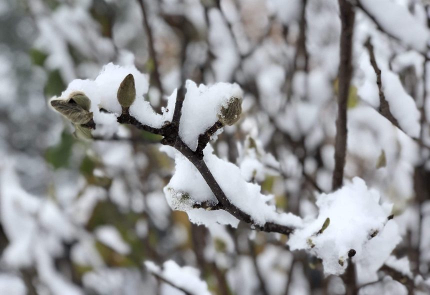
Friday will be mostly cloudy with highs in the lower to mid-40s. Friday night will be cloudy and colder with a mix of rain, freezing rain, snow, and light sleet. Lows will be in the lower 20s.

Central Mississippi
Friday will be cloudy with a chance of morning showers. Highs will be in the lower to mid-50s. Friday night will be cloudy and colder. Freezing rain, sleet, and snow are possible overnight. Lows will be in the lower to mid-30s.
Southern Mississippi
It will be mostly cloudy during the day with a slight chance of morning showers. Highs will be in the mid-60s. Friday night will be cloudy with a chance of showers. Lows will be in the mid-40s.
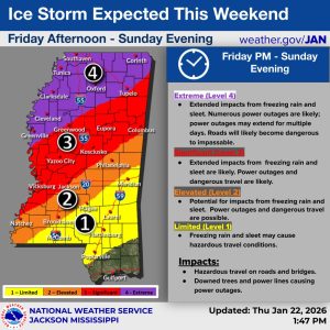
Ice storm outlook
The latest forecast from the National Weather Service shows the first Winter Storm Fern’s impacts on Mississippi will hit the northernmost part of the state as early as 6 p.m. on Friday and creep southwest to Greenville. Expected conditions are currently categorized as “extreme,” meaning extended impacts could include freezing rain and sleet. Numerous power outages, some of which could extend for multiple days, are “likely,” NWS said.
Early Saturday morning, still severe but slightly lesser conditions are forecast to move southward and take over much of central Mississippi. Elements such as freezing rain and sleet will keep trekking south throughout the day and into the night, reaching as far as just below Hattiesburg on Sunday morning. Wintery conditions throughout the majority of the state are expected to remain through Sunday evening.